
Learning about the French regions can become an exciting adventure thanks to fun and interactive methods. Imagine board games where each player must match culinary specialties, monuments, or traditions to the correct region. Or mobile applications that turn administrative borders into geographical challenges.
Teachers are innovating by organizing treasure hunts in playgrounds, where the clues are based on geographical facts. Armed with maps and compasses, children immerse themselves in learning while having fun. These interactive approaches transform classrooms into exploration grounds, making geography accessible and captivating.
See also : "In every respect or in all respects: how to use these expressions correctly in French"
Games and Activities to Discover the French Regions
To make learning about the French regions more appealing, various games and activities can be implemented. One of the most popular is the geographical game, which focuses on France and teaches the 13 metropolitan regions. This type of game often includes exercises to match the capital cities with their respective regions, turning what could be a monotonous task into a stimulating challenge.
Another playful tool is the puzzle of the regions map. This game involves assembling the different pieces representing the regions on a blank map of France. By manipulating the pieces, children intuitively memorize the locations and outlines of the regions. Here are some ideas for practical activities:
See also : Keys to Developing a Leadership Mindset in Daily Management
- Use a map of the regions glued onto cardboard and attach small flags on wooden sticks to identify the capital cities.
- Organize relay races where participants must correctly place labels naming the regions on a blank map of France.
- Offer interactive online quizzes where each correct answer reveals a part of an image of a famous monument from the relevant region.
These activities turn learning into a game where each step taken brings a new discovery. While having fun, children thus acquire solid and lasting geographical knowledge. 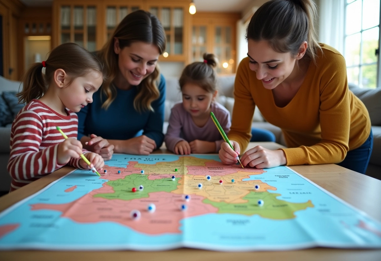
Resources and Educational Tools for Fun Learning
To support the learning of the French regions, various educational tools are available. The map of the regions proves to be essential. Glue it onto a cardboard to make it sturdier and more durable. Add small flags representing the capital cities, fixed on wooden sticks. This method helps children visualize and memorize geographical locations.
Online educational games are another valuable resource. For example, interactive applications allow children to place the regions on a blank map or answer quizzes to test their knowledge. These digital tools offer a dynamic and motivating approach.
| Tool | Usage |
|---|---|
| Map of the regions | Visualization of the regions |
| Small flags on wooden sticks | Identification of capital cities |
| Interactive applications | Geographical quizzes and puzzles |
Teachers can also organize creative workshops where children make their own maps and flags. These hands-on activities promote engagement and understanding. Illustrated books on French geography, with maps and anecdotes, captivate the attention of young readers and enrich their knowledge.
These resources and tools, by mixing play, technology, and creativity, make learning about the French regions not only educational but also enjoyable and stimulating.